Shopping Cart
There are no more items in your cart


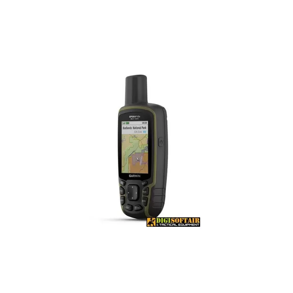
Portable multiband / multi-GNSS navigator with sensors
THE WORLD IS TO EXPLORE. FIND THE BEST WAY TO DO IT.
Push your boundaries with new portable GPS and best-in-class tracking accuracy, 2.6-inch color screen, and preloaded maps.
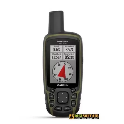
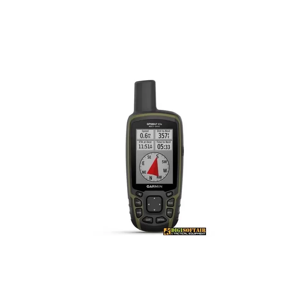
Never miss a detail thanks to the large anti-glare color screen.
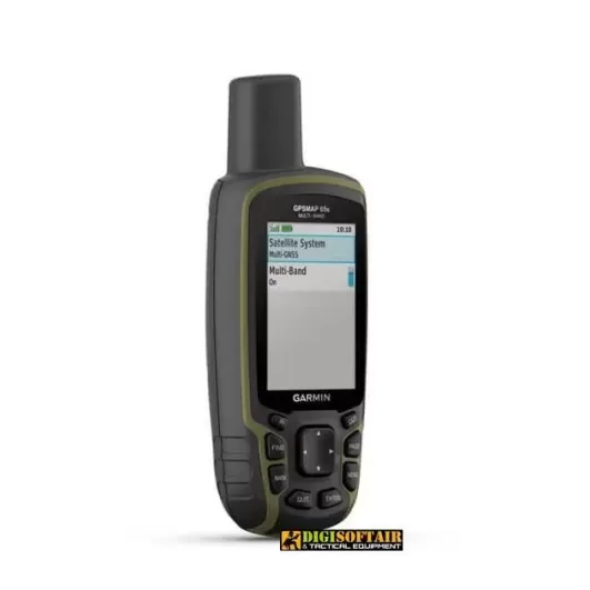
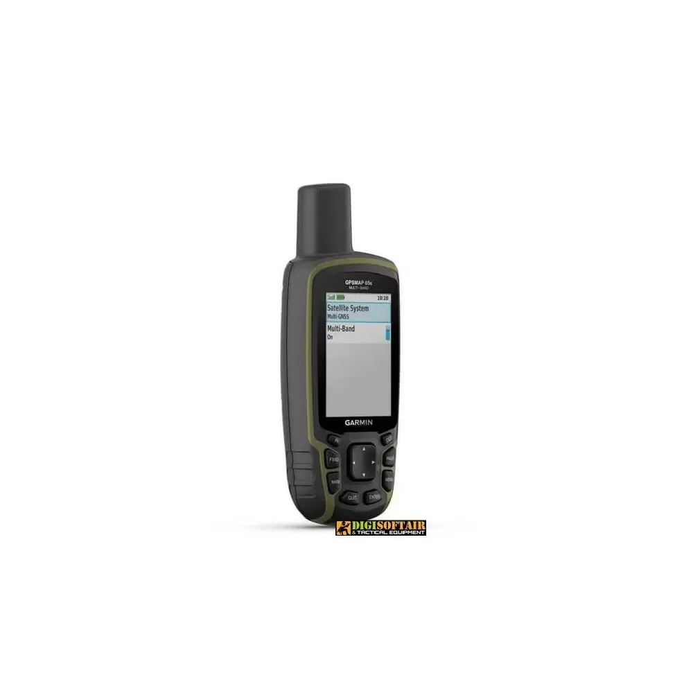
Explore the most remote areas with innovative multi-band technology and expanded GNSS satellite support.
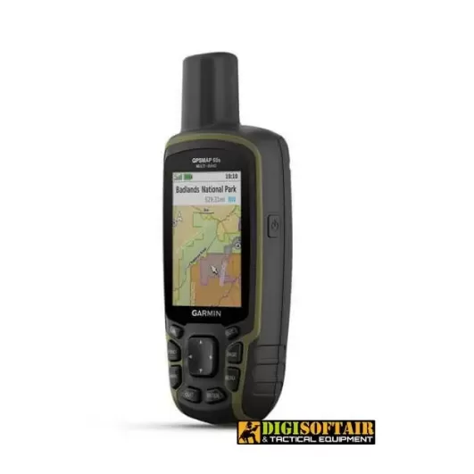
Traverse the open spaces with the support of TopoActive Europe maps.
Track your next route with integrated navigation sensors.
Plan your outing anywhere with the Garmin Explore ™ 1 website and app.
Travel with the confidence of up to 16 hours of battery life in GPS mode.
THE WORLD IS TO EXPLORE. FIND THE BEST WAY TO DO IT.
Push your boundaries with new portable GPS and best-in-class tracking accuracy, 2.6-inch color screen, and preloaded maps.
Never miss a detail thanks to the large anti-glare color screen.
Explore the most remote areas with innovative multi-band technology and expanded GNSS satellite support.
Traverse the open spaces with the support of TopoActive Europe maps.
Track your next route with integrated navigation sensors.
Plan your outing anywhere with the Garmin Explore ™ 1 website and app.
Travel with the confidence of up to 16 hours of battery life in GPS mode.
Get ready to discover the world in a new way with Garmin's GPS Map 65s. This portable, water-resistant device is packed with advanced features like pre-loaded topographical maps, a 3-axis electronic compass, a barometric altimeter, and high-sensitivity satellite technology. The intuitive interface makes it easy to plan routes and navigate safely and accurately.
Plus, with the ability to use microSD cards, you can store all the data and information you need for your outdoor adventures. Connect with other devices via Bluetooth® and ANT+® to share navigation data or use the LiveTrack feature to share your location in real time.
Whether you are an avid hiker, camper or cyclist, Garmin's GPS Map 65s is the ideal tool to help you reach your goal safely and accurately
EXTENDED GNSS SUPPORT
Support for multi-band technology and GNSS (GPS, GLONASS, Galileo, QZSS and IRNSS) provides optimal accuracy in poor reception areas, in cities or in open spaces with obstacles.
ABC SENSORS
Walk each trail with ABC sensors, which include an altimeter for elevation data, a barometer to monitor the weather, and a 3-axis electronic compass.
TOPOACTIVE EUROPE MAPS PRELOADED
TopoActive Europe maps provide detailed views of the road and trail network, waterways, natural features, land use areas, buildings and more.
GEOCACHING
Get automatic cache updates from Geocaching Live, including descriptions, logs and tips.
SMART NOTIFICATION
Receive emails, text messages and alerts directly to your mobile device when paired with a compatible smartphone.
GARMIN EXPLORE APP
Plan, review and sync waypoints, routes, and tracks using the Garmin Explore1 app and website. You can also review completed tasks while still out.
GEOCACHING
Get automatic cache updates from Geocaching Live, including descriptions, logs and tips.
MICROSD ™ SLOT
With your compatible device and a microSD memory card, conveniently download even more detailed maps such as TrekMap Italia V6, the topographical map of our country at a reference scale up to 1: 5,000, a large trail network and ActiveRouting functions to be guided based on your business or means of movement.
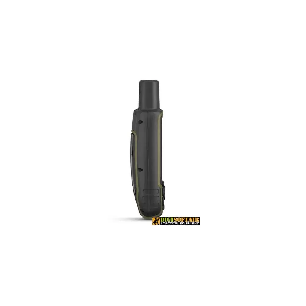
Dimensions 6.1 x 16.0 x 3.6 cm
Screen size, WxH 3.6 x 5.5 cm; 2.6 inches diagonal (6.6 cm)
Screen resolution, WxH 160 x 240 pixels
Screen type 65k color transflective TFT touchscreen
Weight 217 g with batteries
Battery 2 AA batteries (not included); NiMH or lithium recommended
Battery life 16 hours
IPX7 waterproof rating
High sensitivity GPS receiver
Interface Compatible with NMEA 0183 and mini USB high speed
16GB memory / history (user space varies based on included maps)
Maps and memory
Preloaded cartography Yes (TopoActive Europe; navigable)
Additional cartography
World basemap
Automatic route calculation (with precise directions of the turns)
Map segments 3
BirdsEye 250 BirdsEye satellite imagery files
Includes detailed hydrographic information (coastline, river / lake banks, swamps and perennial and seasonal streams)
Includes searchable points of interest (parks, campgrounds, lookout points, and picnic areas)
View national, state and local parks, forests, and nature reserves
Storage and Power Capacity Yes (32GB microSD ™ card max)
Storable positions 5
200 tracks
Track log 10,000 points, 200 saved tracks
Storable routes 200, 250 points per route; automatic route calculation 50 points
Sensors: GPS, GLONASS, Galileo, QZSS, IRNSS
Barometric altimeter
Compass Yes (tilt-compensated, 3-axis)
GPS compass (moving)
Smart daily functions
VIRB ™ remote control
Compatible with Garmin Connect ™ Mobile
Smart notifications on the mobile device
Functions for outdoor activities
Point-to-point navigation
Compatible with BaseCamp ™
Area calculation
Calendar for hunting and fishing
Ephemerides
Suitable for geocaching Yes (computerized)
Compatible with custom maps Yes (500 custom map tiles)
Image viewer
External applications
Compatible with Garmin Explore ™ app
Compatible with Garmin Explore website
Connections
Wireless connectivity Yes - Bluetooth®, ANT + ®
Tap to zoom